


Bay Springs Baptist Church, Shelby County, Alabama
About
Outline

Summary
| Unique Area Identifier | 522884 |
| Name | Bay Springs Baptist Church |
| County | Shelby County |
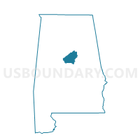
| State | Alabama |
| Area (square miles) | 22.24 |
| Land Area (square miles) | 18.34 |
| Water Area (square miles) | 3.91 |
| % of Land Area | 82.44 |
| % of Water Area | 17.56 |
| Latitude of the Internal Point | 33.06495390 |
| Longtitude of the Internal Point | -86.54932570 |
Maps


Graphs
Select a template below for downloading or customizing gragh for Bay Springs Baptist Church, Shelby County, Alabama


Neighbors
Neighoring Voting District (by Name) Neighboring Voting District on the Map
- Cane Creek Fire Station, Chilton County, AL
- Fayettville -Co Line, Talladega County, AL
- Old Shelby Elementary School, Shelby County, AL
- Pct. 1318 Marble Valley Fire Dept., Coosa County, AL
- Union Grove Fire Station, Chilton County, AL
Top 10 Neighboring County Subdivision (by Population) Neighboring County Subdivision on the Map
- Sylacauga CCD, Talladega County, AL (22,123)
- Columbiana CCD, Shelby County, AL (12,123)
- Weogufka-Marble Valley CCD, Coosa County, AL (3,927)
- Mineral Springs CCD, Chilton County, AL (3,808)
Top 10 Neighboring Place (by Population) Neighboring Place on the Map
Top 10 Neighboring Unified School District (by Population) Neighboring Unified School District on the Map
- Shelby County School District, AL (170,473)
- Talladega County School District, AL (49,716)
- Chilton County School District, AL (43,643)
- Coosa County School District, AL (11,539)
Top 10 Neighboring State Legislative District Lower Chamber (by Population) Neighboring State Legislative District Lower Chamber on the Map
- State House District 41, AL (73,181)
- State House District 42, AL (48,338)
- State House District 33, AL (43,809)
Top 10 Neighboring State Legislative District Upper Chamber (by Population) Neighboring State Legislative District Upper Chamber on the Map
- State Senate District 14, AL (168,669)
- State Senate District 15, AL (160,461)
- State Senate District 11, AL (125,111)
Top 10 Neighboring 111th Congressional District (by Population) Neighboring 111th Congressional District on the Map
Top 10 Neighboring Census Tract (by Population) Neighboring Census Tract on the Map
- Census Tract 115, Talladega County, AL (5,591)
- Census Tract 9611, Coosa County, AL (3,927)
- Census Tract 307.04, Shelby County, AL (3,874)
- Census Tract 603, Chilton County, AL (3,808)